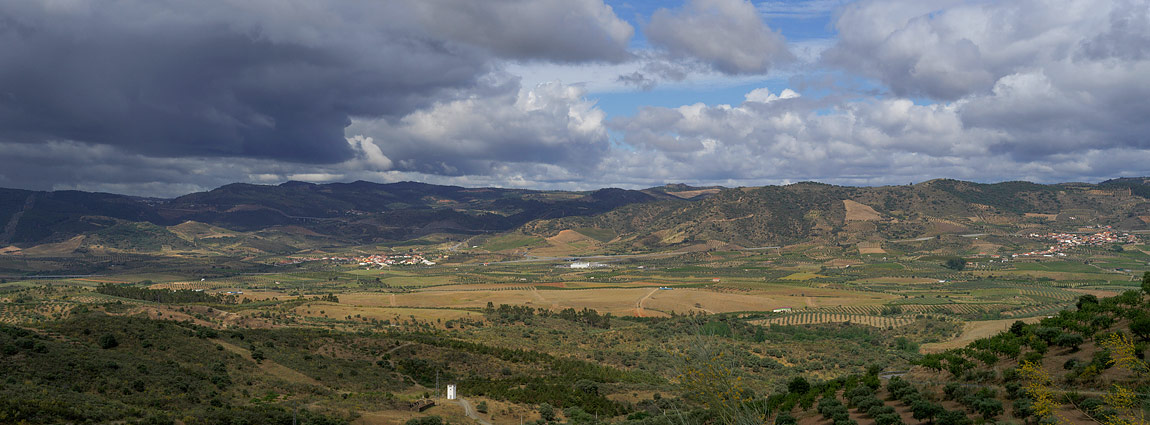
Vilariça Valley, crossed by the Vilarica River, is one of the most fertile regions of Trás-os-Montes (Portugal). With a total area of 34,000 hectares, the alluvial plain occupies 20% of the entire surface. For centuries, hemp cultivation for fibre production was the main agricultural activity, but its importance decreased after the mid-18th century and disappeared altogether. From then on, intensive cereal, tobacco and horticultural crops occupied the attention of local farmers. At present, pumpkin, melon, cabbage, beans, tomato and strawberries are among the most cultures. Although we can see vineyards, this crop, as well as almonds, olives and orange trees, now occupy more of the slopes of the valley than the alluvial plain. The adjacent cliffs are rich in archaeology, with remains of various prehistoric settlements (Baldoeiro, Santa Cruz da Derruída, Castelo da Mina, Senhora do Castelo), which are splendid viewpoints for landscape photography today.
In summer, the heat is unbearable. High temperatures, in conjunction with high humidity caused by the presence of the river, led in the near past to the local occurrence of malaria outbreaks. This unhealthy situation occasioned the abandonment of some villages and the foundation of new settlements in higher places; such was the case of Santa Cruz da Derruída, abandoned in the 13th century to settle in a higher position, giving rise to the current town of Torre de Moncorvo, at an altitude of 350 m.
This photograph was captured one morning last May. The sky threatened rain, but only a few drops fell from the sky. I was fascinated by the order, diversity and geometry that emerged from this grandiose landscape. In the valley, all available land is used. We can still see some unused land with bushes and meadows on the slopes, but orchards dominate. This landscape has the memory of the man who modified it for centuries to his advantage but did not degrade it. The image was captured with a Hasselblad X1D-50c in crop mode.


