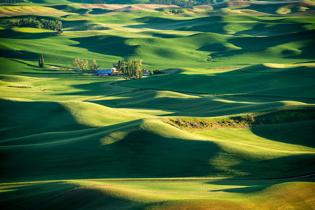
The Palouse, a region of rolling hills in eastern Washington State, has sometimes been compared to Tuscany. While that may be a stretch, the Palouse possesses its own unique charm and extraordinary beauty, albeit without the Italian cuisine, historical buildings, and atmosphere. What truly makes the Palouse special are the undulating loess hills, which, in June, are covered with vibrant spring growth of wheat and other legumes. The Palouse Loess consists of windblown sediment that formed the rolling hills, similar to sand dunes along a beach, which explains why the dirt roads can be very dusty. Early mornings and evenings provide stunning highlights and shadows, enriched by the various shades of green from fresh growth and the brown sediment peeking through.
A favorite spot for photographers and visitors is the 3,612-foot high Steptoe Butte. Personally, I find the drive up a bit nerve-racking, but it’s not as challenging as the back roads of the Colorado Rockies. From this elevation, you’re rewarded with a panoramic view of farms, hills, and valleys. The image taken at the top of Steptoe at sundown captures the beauty of the area and is emblematic of the wonderful sights there. However, it's essential to explore beyond Steptoe to fully enrich your visit, as there are many other excellent vantage points, barns, towns, and intriguing images to capture and discover.
Unfortunately, much of the Palouse lacks cell phone coverage, so it's advisable to use an offline map or a printed map for navigation. During my search for photographic spots and information about the Palouse, I discovered that the Palouse Chamber of Commerce offers a helpful, free map to help locate some hidden vantage points and gems.


