

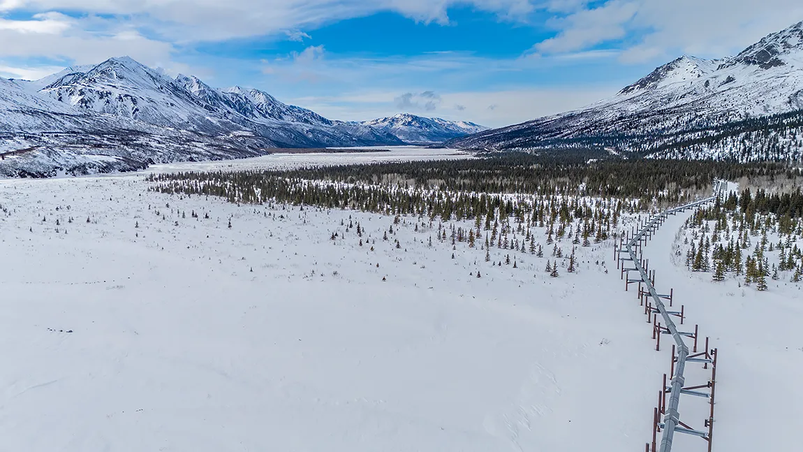
An aerial perspective of the elevated Trans-Alaska Pipeline cuts through a winter landscape, bordered by a frozen river plain and the Alaska Range. What you are seeing on the right is the zig-zagging structure. It runs 800 miles from Prudhoe Bay to Valdez and is built above ground on Vertical Support Members (VSMs) in this section to keep the warm oil from thawing the underlying permafrost.
The Delta River Valley is an expansive, flat, snow-covered area, and in the center is the frozen Delta River. The prominent snowcapped mountain ridges framing both sides of the valley are the Alaska Range, and the scattered evergreen spruce trees dotting the valley floor are the Boreal forest.