A very dry monsoon season across southern Utah/northern Arizona had left me feeling quite frustrated. The three words I dreaded seeing repeatedly in the forecasts were “upper level stability”, where instability is what’s needed to produce a strong storm. Toward the end of the season, I had spent an entire afternoon waiting on storms to arrive at a chosen location, only to have them produce a couple of fairly weak bolts. On the way home, once again disappointed, I took one last look at the radar. Multiple cells were colliding, producing some lightning bolts and a lot of rain — a soupy mess.
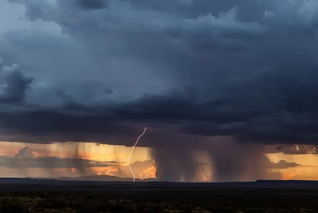
I decided to take a chance and drive through the middle of the storms, trying to photograph them from the back side. Typically, that’s not the best way to capture lightning – you want to be in front of a storm cell or at least adjacent to it as it tracks across your viewpoint. A half hour later, I found myself looking at a gorgeous sunset through a curtain of rain cells, in the exact opposite direction I had intended to shoot. The only problem was that it was still raining on the one gravel road in the remote area I could trust not to get stuck on. So I pulled over, set my tripod and two cameras w/ lightning triggers up on the folded-down back seat, and shot thru the open car window. (Note: I often set up two or three cameras with varying focal lengths and pointed in different directions to be sure I don’t miss any storm action.)
For the next hour, I caught dozens of beautiful lightning strikes as sunset faded into twilight and then into full dark. This is one of the best from that evening. Finally, the (literal) drought of weak or non-existent storms in the region was broken!


